Outputs
This page provides access to local authority profiles, policy briefings and academic articles which report results from the PopChange project and associated research.
PopChange is exploring how the population of the UK is, or has been, geographically distributed. The project brings a new and important perspective to debates about divisions, inequalities and the ways in which people in the UK live together or apart. It is addressing questions such as: are health inequalities between places greater now than in the past? What makes localities different - are they geographically distinguished more by housing tenure or health than they are by employment status or ethnicity? What areas have the greatest diversity of people and how has this changed? Below are publications which detail research on some of these themes. All of the publications listed are open access and can be read and downloaded by anyone.

Local authority housing space profiles
The profiles summarise local-level data on housing spaces - overcrowding (1971-2011), persons per room (1971-2011), and dwellings per person (1991-2017). Profiles are available for all local authorities in England. An England-wide analysis of the data is provided by Lloyd and Gleeson (2020) - Briefing 4 below.
The profiles are the first on a series of themes - please check these pages for updates or email Chris Lloyd to be added to the PopChange mailing list.
The profiles are available here. The main audience for the profiles is intended to be local authorities and central government departments, but we hope that they will be useful to others as well. If you use these profiles we would really appreciate comments on how they have been used and where they are cited. Without this feedback they won't develop and expand. If you are interested in equivalent profiles for the other nations of the UK please email Chris Lloyd, and we will try to move onto these soon (assuming necessary data are available).
The data used in producing the profiles are freely-available here, and supporting metadata are here.
Briefings
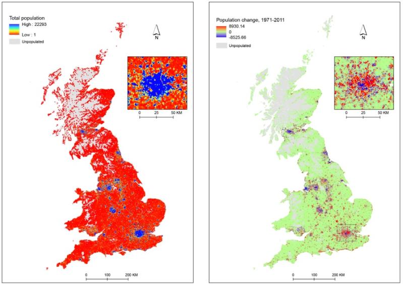
1. Lloyd, C. D., Catney, G., Williamson, P. and Bearman, N. (2017) Population Change in Britain. PopChange Briefing 1. Liverpool: Centre for Spatial Demographics Research, University of Liverpool.
2. Lloyd, C. D., Catney, G., Williamson, P., Bearman, N. and Norman, P. (2018) Deprivation Change in Britain. PopChange Briefing 2. Liverpool: Centre for Spatial Demographics Research, University of Liverpool.
3. Lloyd, C. D., and Gleeson, J. (2018) Housing Tenure Change in England. PopChange Briefing 3. Liverpool: Centre for Spatial Demographics Research, University of Liverpool.
4. Lloyd, C. D., and Gleeson, J. (2020) Housing Space Change in England. Belfast: School of Natural and Built Environment, Queen's University Belfast.
Journal papers
1. Lloyd, C. D., Catney, G., Williamson, P. and Bearman, N. (2017) Exploring the utility of grids for analysing long term population change. Computers, Environment and Urban Systems, 66, 1-12
2. Dearden, E., Lloyd, C. D. and Catney, G. (2019) A spatial analysis of health status in Britain, 1991–2011. Social Science and Medicine, 220, 340–352.
3. Dearden, E., Lloyd, C. D. and Green, M. (2019) Exploring the histories of health and deprivation in Britain, 1971 to 2011. Health and Place, 61, 102255
4. Catney, G. and D. Lloyd (2020) Population grids for analysing long-term change in ethnic diversity and segregation. Spatial Demography, 8, 215–249.
5. Lloyd, C. D. and J. Gleeson (2022) Housing space in England at the neighbourhood-level, 1971 to 2017. Applied Spatial Analysis and Policy, 15, 1433–1467.
6. Lloyd, C. D. (2022) Neighbourhood change, deprivation, and unemployment in Belfast. The Geographical Journal, 188, 190–208.
7. Lloyd, C. D., P. Norman and D. McLennan (2023) Deprivation in England, 1971-2020. Applied Spatial Analysis and Policy, 16, 461–484.